Scotland: Ben Nevis via the Mountain Track
27th September 2026
Ben Nevis is the highest mountain in Scotland, indeed the highest in the United Kingdom and the British Isles.
The way we walked up Ben Nevis, the "Mountain Track", is also known as the “Pony Track” or “Tourist Path”, although calling it by the name “Tourist Path” doesn't seem to convey how difficult and dangerous Ben Nevis can be for people who are underprepared.
The summit of Ben Nevis is often in cloud; navigation can be difficult and there is close proximity to gullies and cliff edges. The weather can suddenly become bitterly cold, even in summer, with strong winds. Snow (and avalanche risks) can be present too.
This blogpost is not a walking guide, so I am not showing a map or quoting compass bearings and distances here, however it is prudent to do research into safety considerations before attempting Ben Nevis.
On the ascent, at a certain height it became cold with a chilly breeze, so I was glad that I was suitably prepared with items such as gloves and windproof apparel (as well as wearing good hiking boots and having water, food, map, compass, whistle etc).
We went up Ben Nevis in August when all the snow had melted. There aren’t many days of the year when there is good visibility at the summit, however we got good visibility at the summit for about half an hour. As soon as I sensed the cloud arriving, the decision was made that I would start walking back down; I didn’t need to get a compass out of my rucksack because I found that there was enough time for me to safely make my way back down the Mountain Track.
We started and finished the walk at the Ben Nevis Visitor Centre. There were lots of people making the walk when we started at around 9.30am, however we managed to find a space for the car in the car park. We got back to the car at around 7pm; the walk had taken us about nine and a half hours from start to finish. I was careful not to rush the walk and I am happy with the images I obtained. I am glad that the day had stayed dry; I would not have attempted the walk if the weather had been wet.
Below are some of the images.
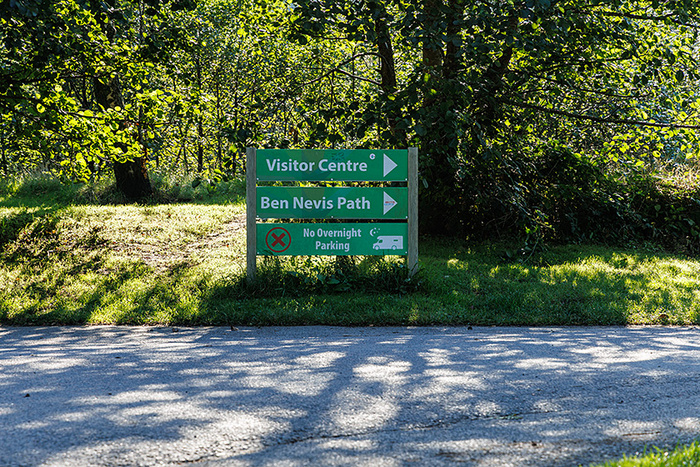
Signage at Ben Nevis Visitor Centre car park.
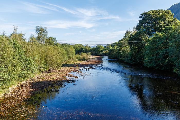
After leaving Ben Nevis Visitor Centre, we crossed the bridge over the River Nevis. People were constantly walking across the bridge and it was bouncing as I was taking photographs.
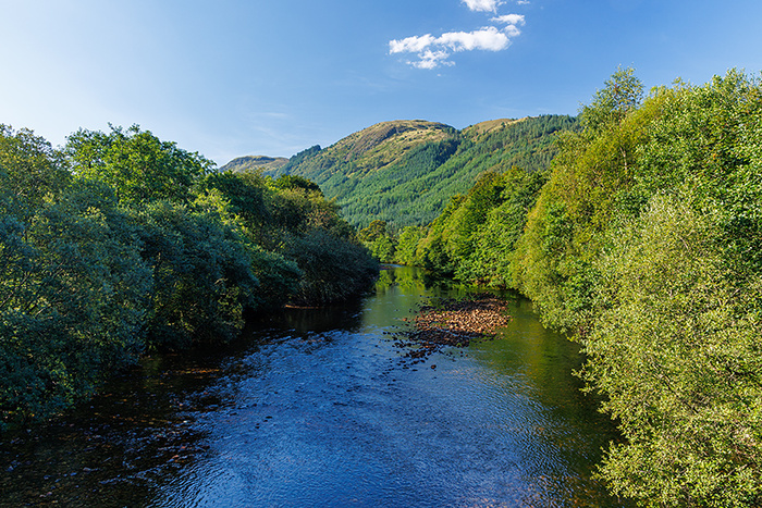
Another view looking from the bridge, but this time looking in the opposite direction to the previous image.
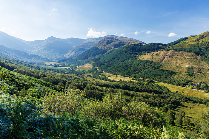
The view of the Glen Nevis valley was amazing. The weather was warm at that level (I captured this image after about 35 minutes of uphill walking after leaving the bridge over the River Nevis), however it was chilly and breezy later for some of the zig-zag sections of the walk and for the summit.
We stopped for a while at this location by the lochan (small loch or lake), to rest and have some food and water before continuing. The name of the lochan is “Lochan Meall an t-Suidhe”. The lochan is commonly referred to as the “Halfway Lochan”, although it is at a height of “only” about two-fifths of the height of Ben Nevis not half of the height. I found that the Ben Nevis Mountain Track in this area was relatively gentle, a break between steep sections.
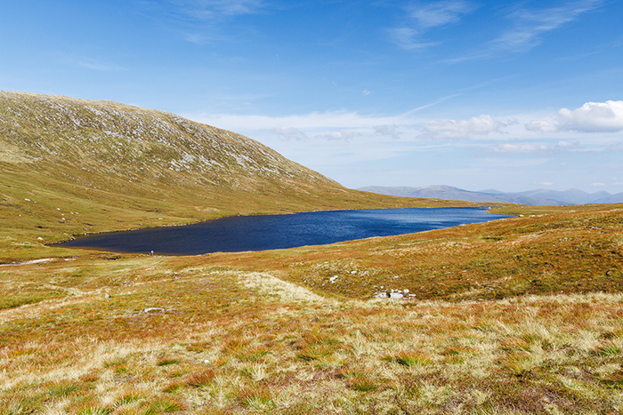
Looking back from the Ben Nevis Mountain Track, at part of the trail far below. Glen Nevis is visible from here, and the line of the River Nevis meandering through it. Parts of Loch Linnhe and Loch Eil can also be seen in the picture. (I captured this image about 45 minutes after the lochan picture; we had been walking further up the Ben Nevis Mountain Track for quite some time since the break at the lochan).
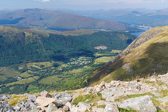
Loch Linnhe and Loch Eil can be seen in this picture. (We reached the location for this image about 30 minutes after I captured the previous image).
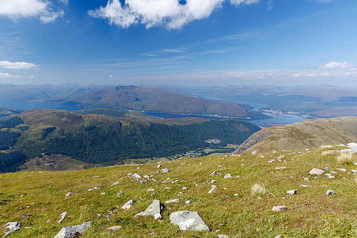
Looking across Meall an t-Suidhe. The Narrows can be seen, joining Loch Linnhe to Loch Eil. Corpach is also visible in the picture.
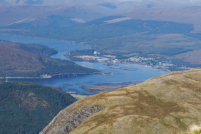
Looking over a cliff edge. The Ben Nevis Mountain Track goes close to the edge around here, however I found a safe way to stay further from the edge. (I was glad that the weather conditions were allowing good visibility).
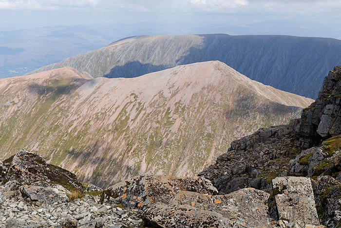
Looking from the summit of Ben Nevis, with Loch Eil in the distance.
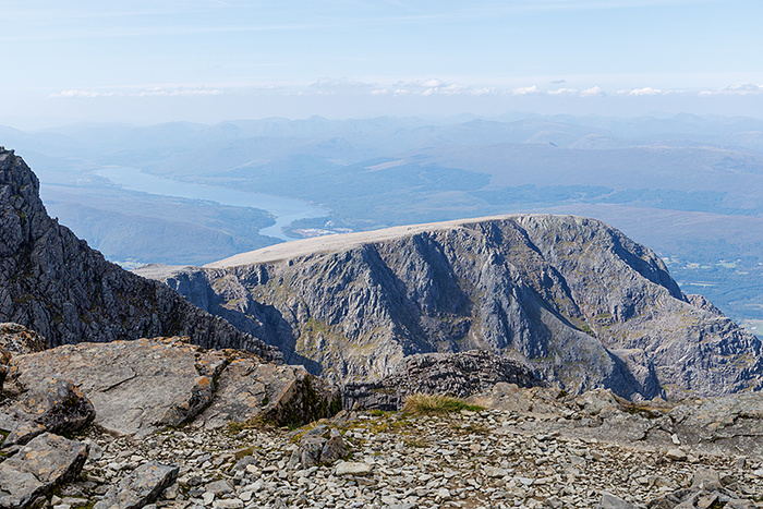
A vertical image from the summit of Ben Nevis.
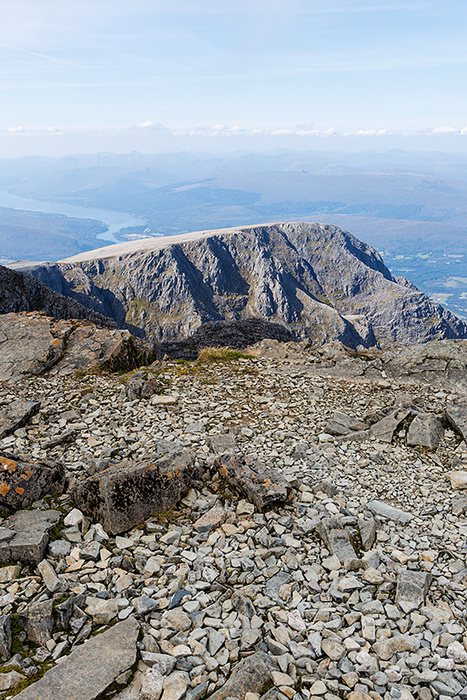
The summit of Ben Nevis.
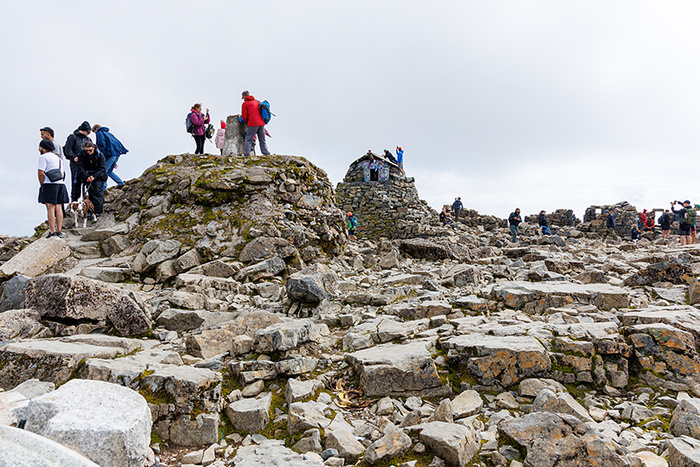
A view as I descended the mountain. I was glad that (despite the cloud) the visibility of the path stayed good while I made the descent, as there are treacherous gullies around the area.
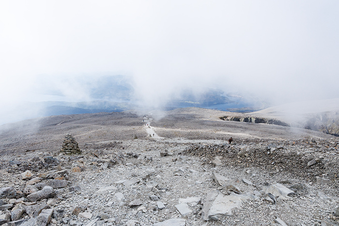
Another view from the same position, one minute later. Visibility can change rapidly; weather conditions can change fast.
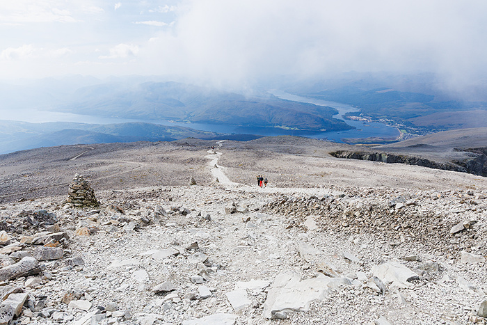
A view from the Ben Nevis Mountain Track, looking down over Meall an t-Suidhe and Lochan Meall an t-Suidhe (the “Halfway Lochan”), to Glen Nevis and Fort William far below.
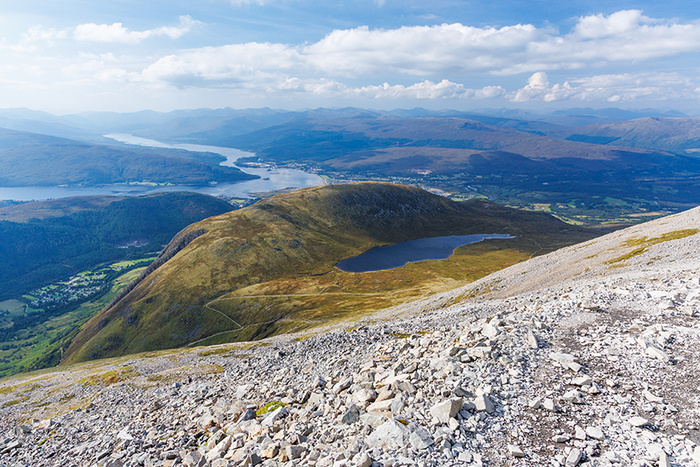
I have added the image “View from the Mountain Track” to the Photo4me photographic wall art gallery website. The in-situ mockup image below is courtesy of Photo4me.
In-situ mockup image courtesy of Photo4me. (Low resolution image for promotional web display purposes).
To view the above image on Photo4me, please visit View from the Mountain Track on Photo4me (clickable link).
I have also added the picture “Lochan Meall an t-Suidhe” to my portfolio on the online sales gallery Photo4me. The in-situ mockup image below is courtesy of Photo4me.
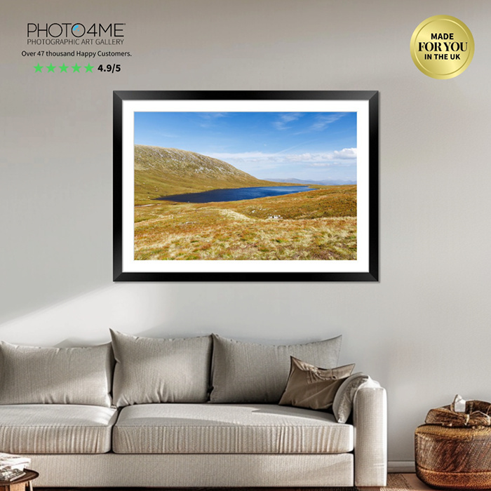
In-situ mockup image courtesy of Photo4me. (Low resolution image for promotional web display purposes).
To view the above image on Photo4me, please visit Lochan Meall an t-Suidhe on Photo4me (clickable link).
Blogpost disclaimer:
Weather, lighting and ground conditions may vary. Fitness levels may vary. The inclusion of a walk does not guarantee a public right-of-way. Information on walks is given in good faith. Walks information is not professional advice so should not be taken to be such.
The way we walked up Ben Nevis, the "Mountain Track", is also known as the “Pony Track” or “Tourist Path”, although calling it by the name “Tourist Path” doesn't seem to convey how difficult and dangerous Ben Nevis can be for people who are underprepared.
The summit of Ben Nevis is often in cloud; navigation can be difficult and there is close proximity to gullies and cliff edges. The weather can suddenly become bitterly cold, even in summer, with strong winds. Snow (and avalanche risks) can be present too.
This blogpost is not a walking guide, so I am not showing a map or quoting compass bearings and distances here, however it is prudent to do research into safety considerations before attempting Ben Nevis.
On the ascent, at a certain height it became cold with a chilly breeze, so I was glad that I was suitably prepared with items such as gloves and windproof apparel (as well as wearing good hiking boots and having water, food, map, compass, whistle etc).
We went up Ben Nevis in August when all the snow had melted. There aren’t many days of the year when there is good visibility at the summit, however we got good visibility at the summit for about half an hour. As soon as I sensed the cloud arriving, the decision was made that I would start walking back down; I didn’t need to get a compass out of my rucksack because I found that there was enough time for me to safely make my way back down the Mountain Track.
We started and finished the walk at the Ben Nevis Visitor Centre. There were lots of people making the walk when we started at around 9.30am, however we managed to find a space for the car in the car park. We got back to the car at around 7pm; the walk had taken us about nine and a half hours from start to finish. I was careful not to rush the walk and I am happy with the images I obtained. I am glad that the day had stayed dry; I would not have attempted the walk if the weather had been wet.
Below are some of the images.
Signage at Ben Nevis Visitor Centre car park.
After leaving Ben Nevis Visitor Centre, we crossed the bridge over the River Nevis. People were constantly walking across the bridge and it was bouncing as I was taking photographs.
Another view looking from the bridge, but this time looking in the opposite direction to the previous image.
The view of the Glen Nevis valley was amazing. The weather was warm at that level (I captured this image after about 35 minutes of uphill walking after leaving the bridge over the River Nevis), however it was chilly and breezy later for some of the zig-zag sections of the walk and for the summit.
We stopped for a while at this location by the lochan (small loch or lake), to rest and have some food and water before continuing. The name of the lochan is “Lochan Meall an t-Suidhe”. The lochan is commonly referred to as the “Halfway Lochan”, although it is at a height of “only” about two-fifths of the height of Ben Nevis not half of the height. I found that the Ben Nevis Mountain Track in this area was relatively gentle, a break between steep sections.
Looking back from the Ben Nevis Mountain Track, at part of the trail far below. Glen Nevis is visible from here, and the line of the River Nevis meandering through it. Parts of Loch Linnhe and Loch Eil can also be seen in the picture. (I captured this image about 45 minutes after the lochan picture; we had been walking further up the Ben Nevis Mountain Track for quite some time since the break at the lochan).
Loch Linnhe and Loch Eil can be seen in this picture. (We reached the location for this image about 30 minutes after I captured the previous image).
Looking across Meall an t-Suidhe. The Narrows can be seen, joining Loch Linnhe to Loch Eil. Corpach is also visible in the picture.
Looking over a cliff edge. The Ben Nevis Mountain Track goes close to the edge around here, however I found a safe way to stay further from the edge. (I was glad that the weather conditions were allowing good visibility).
Looking from the summit of Ben Nevis, with Loch Eil in the distance.
A vertical image from the summit of Ben Nevis.
The summit of Ben Nevis.
A view as I descended the mountain. I was glad that (despite the cloud) the visibility of the path stayed good while I made the descent, as there are treacherous gullies around the area.
Another view from the same position, one minute later. Visibility can change rapidly; weather conditions can change fast.
A view from the Ben Nevis Mountain Track, looking down over Meall an t-Suidhe and Lochan Meall an t-Suidhe (the “Halfway Lochan”), to Glen Nevis and Fort William far below.
I have added the image “View from the Mountain Track” to the Photo4me photographic wall art gallery website. The in-situ mockup image below is courtesy of Photo4me.
In-situ mockup image courtesy of Photo4me. (Low resolution image for promotional web display purposes).
To view the above image on Photo4me, please visit View from the Mountain Track on Photo4me (clickable link).
I have also added the picture “Lochan Meall an t-Suidhe” to my portfolio on the online sales gallery Photo4me. The in-situ mockup image below is courtesy of Photo4me.
In-situ mockup image courtesy of Photo4me. (Low resolution image for promotional web display purposes).
To view the above image on Photo4me, please visit Lochan Meall an t-Suidhe on Photo4me (clickable link).
Blogpost disclaimer:
Weather, lighting and ground conditions may vary. Fitness levels may vary. The inclusion of a walk does not guarantee a public right-of-way. Information on walks is given in good faith. Walks information is not professional advice so should not be taken to be such.